It is ironic that the tourism in Montalban largely depends on its mountains, rolling hills, and trails, but at the same time has been plagued with quarry sites that are not just unsightly but posing possible dangers.
Quarrying has been a long-time environmental concern in Montalban and there's no sign that it will stop soon. In fact, it's the opposite: quarry sites and the damages to the mountains of Montalban have reached monumental proportions.
The quarrying isn't new
Sad to say, my earliest memory of the quarrying problems in Montalban goes as far back as the 90's.
I still recall making a cartoon for an editorial article for our school newspaper about the quarrying in Montalban back in grade six ─ a caricature, rather, a poorly drawn mountain with a crying face being destroyed by a backhoe.
Montalban's quarrying problems have persisted for as long as I can remember and there's no sign that it will be stopped soon.
Montalban is most famous for the Wawa Dam and river and the amazing giant white rocks that can be seen there.
Montalban's quarrying problems have persisted for as long as I can remember and there's no sign that it will be stopped soon.
White, blue, and brown
Another place that has gained popularity over the past few years among locals is the Blue Rock river, so named for its proximity to a quarrying company in San Isidro, the Blue Rock Aggregates.
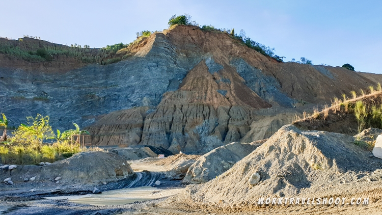
Thanks to this company we can now literally see the blue colored rocks inside our mountains by destroying them and turning the quarried rocks into aggregates.
But there's a color trying to catch up in terms of size and it's very unattractive: brown. As the mountains are quarried, layers after layers of rocks and soil are exposed.

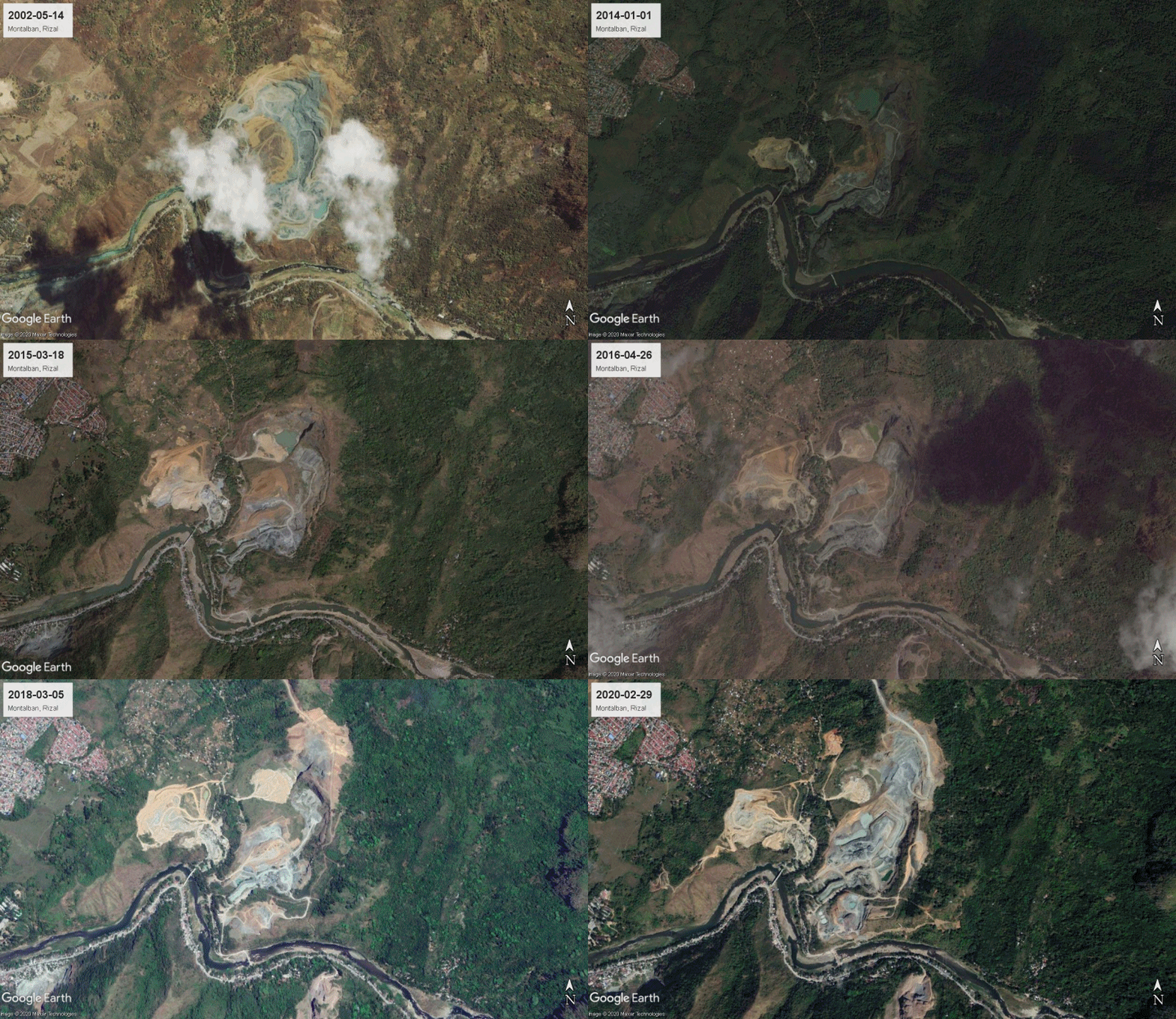
Satellite images of the growing quarry sites
Unless you live near these areas or a local explorer like a biker or mountain hiker, there's little chance that you will get to see the amount of destruction these quarrying sites have done to our town.
And there's not one but two! Two humongous 'quarry areas' in Montalban.
Seeing them from ground level is sad enough.
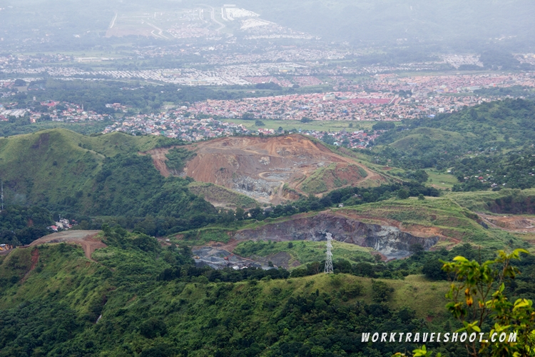
Seeing them from the summit of our mountains, especially from Mt. Pamitinan, invokes another level of sadness. (It's like you climbed all the way there only to be rewarded with an ugly view).
But seeing the whole progression of the destruction through satellite images will make you question why and how humans can do such things.
GIF: Satellite images from 2002 to 2020 of a quarry site in San Rafael, Montalban, Rizal

GIF: Satellite images from 2002 to 2020 of a quarry site in San Isidro, Montalban, Rizal
In photos: the manifestation of humanity's greed
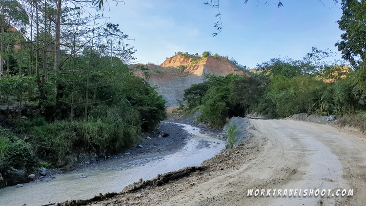
I wanted to say more but let these images do the talking. As you see in the satellite images above, the photos below are just a small portion of the whole thing, and only The One above can see the extent of these quarry sites.
View from the summit of Mt. Pamitinan:
What you will see on the way to the Blue Rock River:
It's exasperating.
Why are they being allowed?
Is there still hope?
If I was living near any of these quarrying sites, I would have evacuated already.
God bless our town.
2020 Update:
I tried reaching out to the Provincial Capitol to request for some documents related to the mining or quarrying in Montalban, hoping that they would be available to the public. Here's the exchange:
From this day, I started to lose hope about the quarrying in Montalban.
Update 2022:
Through some research, I found out about the process on the application of the mining agreement in the Philippines.
It is applied to the MGB or Mines and Geosciences Bureau of every region, and doesn't start at the local government per se.
For me, whether it starts with the LGU or not, whether they are involved or not, true progress should consider the people first and that includes a safe environment.
It is impossible to find a healthy balance between progress, nature, and the welfare of the people, but the way I see it, at the rate the quarried areas in my town is going, I can only feel sorry and be more hopeless.


